
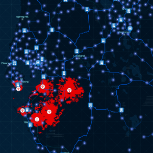

GEOGRAPHIC
Maps in G.I.S are composed of a series of map layers drawn in a particular order. A map layer defines how a GIS dataset is symbolized and labeled (that is, portrayed) in your map views. Cartography is the design and production of maps, or visual representations of spatial data. The vast majority of modern cartography is done with the help of computers, usually using GIS but production of quality cartography is also achieved by importing layers into a design program to refine it. Most GIS software gives the user substantial control over the appearance of the data. The combination of several spatial datasets (points, lines, or polygons) creates a new output vector dataset.
INFORMATION
GIS can relate unrelated information by using location as the key index variable. Locations or extents in the Earth space-time may be recorded as dates/times of occurrence, and x, y, and z coordinates representing, longitude, latitude, and elevation, respectively. All Earth-based spatial–temporal location and extent references should be relatable to one another and ultimately to a „real” physical location or extent. This key characteristic of GIS has begun to open new avenues of scientific inquiry.

SYSTEM
GIS can refer to a number of different technologies, processes, techniques and methods. It is attached to many operations and has many applications related to engineering, planning, management, transport/logistics, insurance, telecommunications, and business.For that reason, GIS and location intelligence applications can be the foundation for many location-enabled services that rely on analysis and visualization.GIS data represents real objects (such as roads, land use, elevation, trees, waterways, etc.) with digital data determining the mix. Real objects can be divided into two abstractions: discrete objects (e.g., a house) and continuous fields (such as rainfall amount, or elevations).

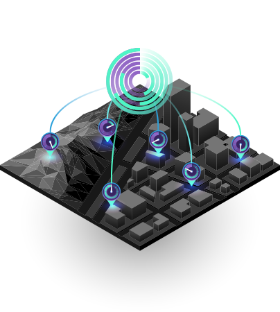
AS BUILD
As-built design activities are done by creating drawings that describe the work as it wasactually built, following the changes in progress. We operate in GIS, for the acquisition, conservation,analysis and visualization of data related to TLC networks and fiber network management. We take care of the drafting of structural projects and verifications, using REVIT software: elaborating modeling of structures, evaluating in detail the static nature of each element in accordance with the current building regulations.